Survey the pit, reconcile the volumes, report the same day.
Drone or LiDAR in. Cut/fill, stockpile volumes, bench contours and underground drive profiles out — measured, checked and reported in one AutoTerra seat.
The trial includes the Tunnel module for underground drives.
The three surveys every mine runs — in one workflow
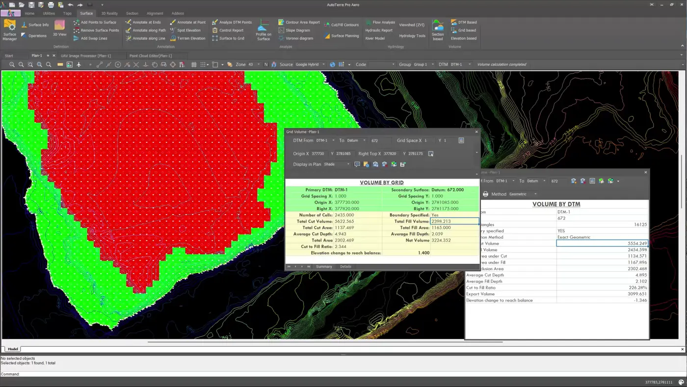
Volumes & reconciliation
- Pit and stockpile volumes between any two surfaces
- Month-on-month cut/fill with a report your billing team can use
- Grid, TIN and section methods to cross-check
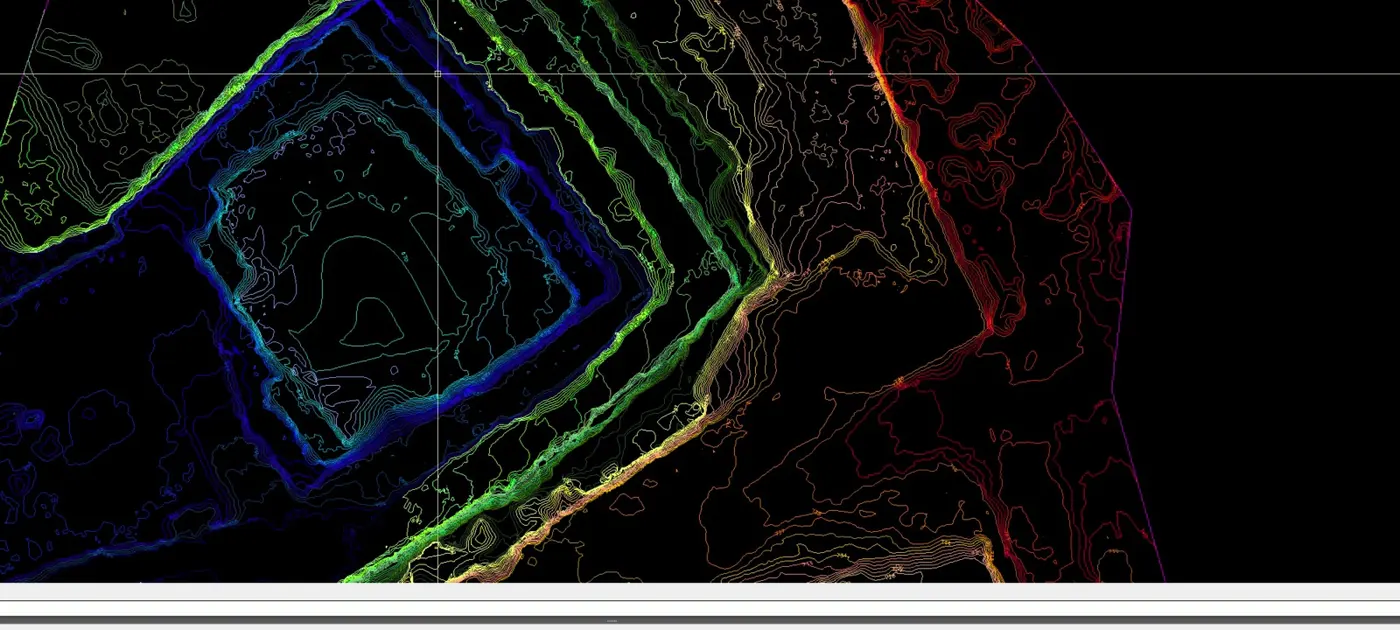
Pit & bench mapping
- Ground classified from drone or LiDAR clouds
- Bench contours, slope and hillshade maps
- Sections across the pit at any interval
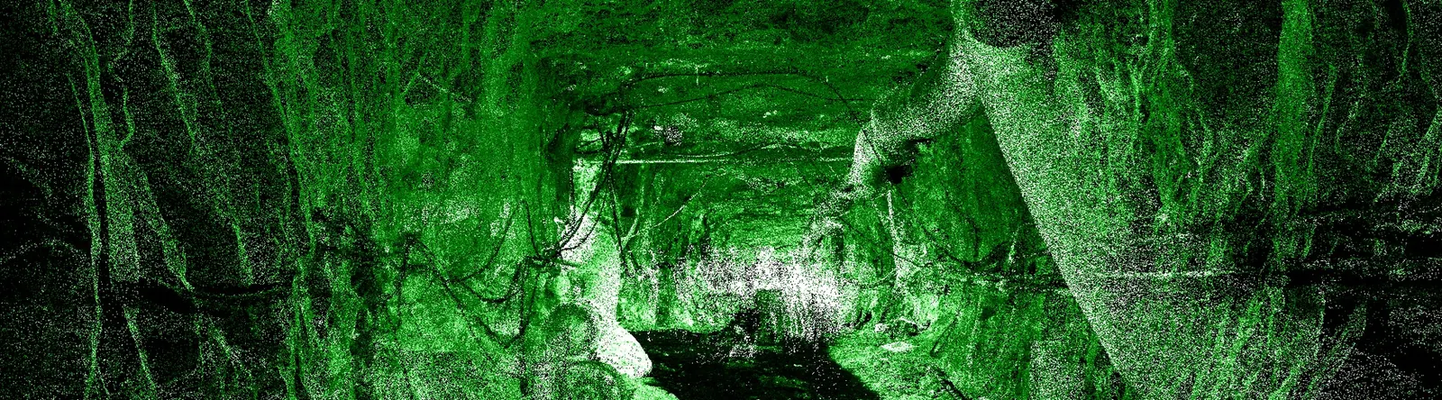
Underground drives
- Profiles from handheld, SLAM or terrestrial scans
- Overbreak and underbreak against design
- Excavated volume by chainage, drive reports
From a morning flight to a signed-off volume
Process the flight to an orthomosaic and DSM, classify the ground, build the surface and compare it with last month — without exporting between programs. Heavy processing can run on AutoTerra Cloud if you don't have a GPU workstation on site.
- Images, GCPs and a QA report you can hand to the client
- Ground and stockpile surfaces from the same cloud
- Cut/fill and volume reports as PDF and Excel
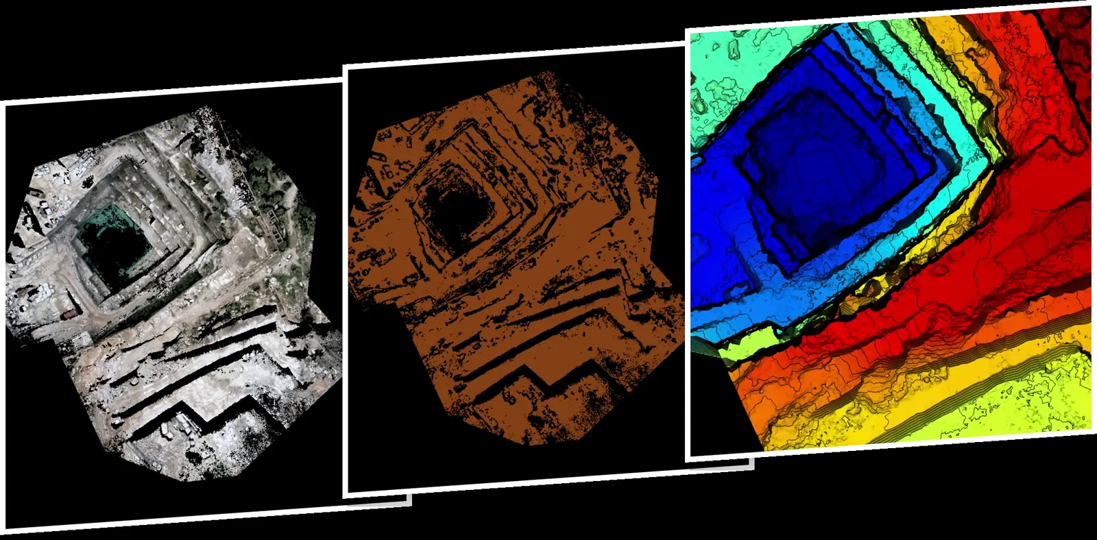
One quarry flight: orthomosaic → classified ground → elevation model.
Drive profiles, audited station by station
Built around working mine drives — rough blasted rock, machinery in the section, a face that moves between surveys. Every ring is checked before it reaches a report, and over- and underbreak are measured against design.
- Circle, horse-shoe, D and rectangular profiles
- Volumes by chainage and a full drive report
- Markers for overbreak, water ingress and rock bolts

A hand-carried scan of a working drive, in AutoTerra.
Contours, sections and haul roads from the same survey
The surface you measured volumes on is the one you plan from: bench contours, sections across the pit, and haul-road alignments with grade limits through AutoRoads.
- Smoothed, labelled contours to DWG
- Sections and long-sections at any interval
- Haul-road alignment with grade limits (AutoRoads)
What you hand over
What a mining team needs
AutoTerra Pro Aero
Drone and LiDAR processing, ML classification, volumes, sections and contours. Cloud credits included.
Start free trial+ Tunnel module
Drive profiles, overbreak and drive reports. Runs on Pro Spatial or Pro Aero.
See the moduleAutoTerra Pro
Total station / GNSS surveys, surfaces, volumes and sections — no point clouds.
See detailsPrices exclude GST or local taxes. Multi-seat and multi-site pricing on request.
Before you start
Do we need a GPU workstation?
No. AutoTerra runs drone processing on CPU-only machines, faster with an NVIDIA GPU — or send the heavy stages to AutoTerra Cloud.
Which scanners and drones work?
Any drone camera with geotags, and LAS/LAZ/E57 from terrestrial, SLAM, handheld or mobile scanners.
How do we check accuracy?
Every drone project produces a GCP report; volume reports state the surfaces and method used.
Can we try it on our own site?
Yes — the 30-day Pro Aero trial is the full platform, including the Tunnel module. Or send us a dataset and we'll walk through it with you.
Run your next mine survey in AutoTerra
Start the 30-day trial, or send us last month's flight and we'll show you the volumes live.