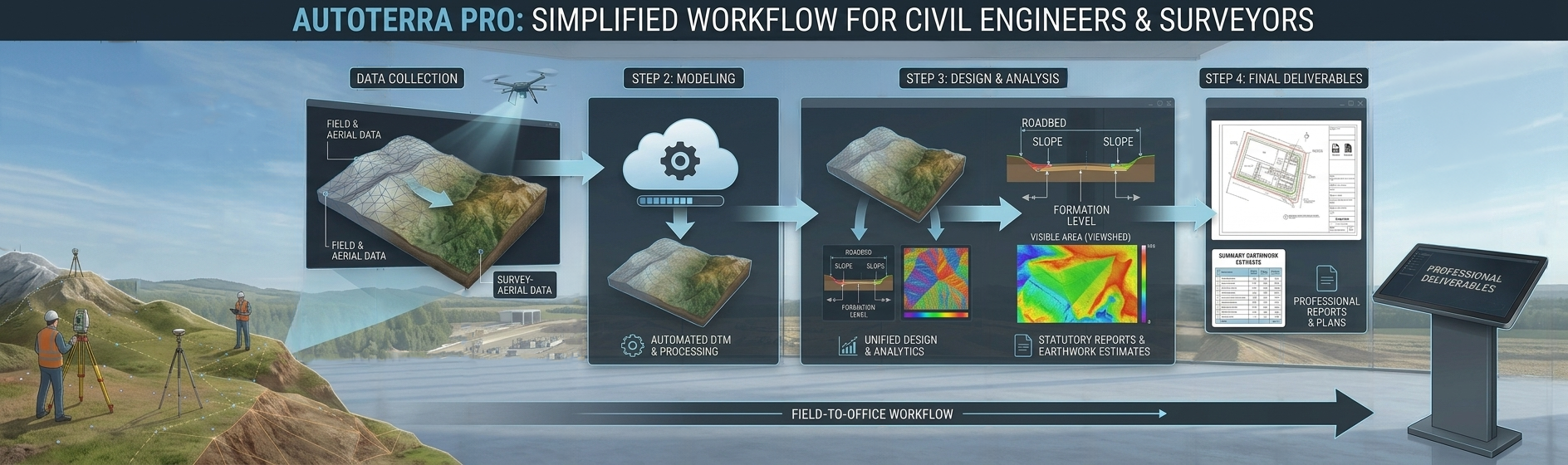
The professional survey and terrain platform for civil engineers and land surveyors. Full DTM generation, cross-section workflows, DXF/DWG integration, and advanced terrain analysis — without the LiDAR scale of Pro Spatial.
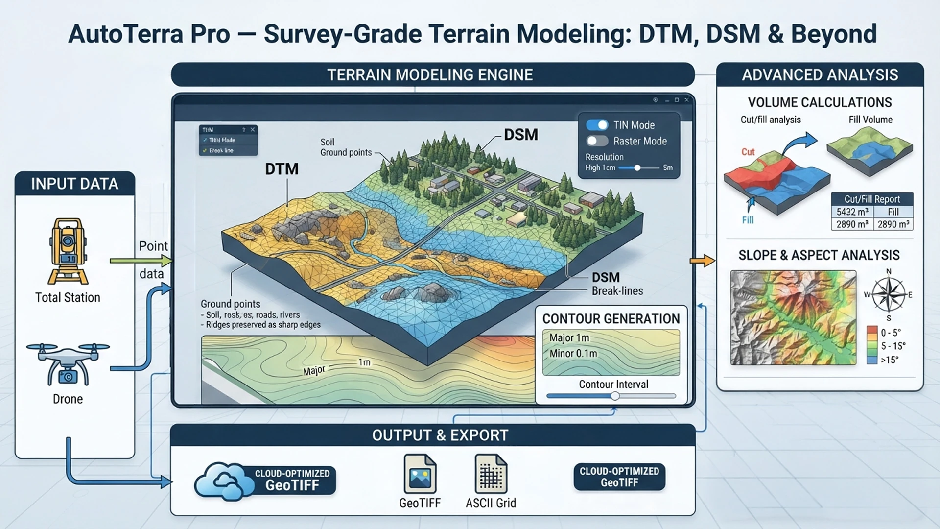
AutoTerra Pro takes your field survey data — from total station traverses, GNSS observations, or drone photogrammetry — and builds precise terrain models using TIN interpolation with full break-line and boundary control. The outputs meet survey-grade accuracy requirements for engineering design and statutory reporting.
Define a horizontal alignment and AutoTerra Pro generates cross-sections at every chainage — cutting through the terrain surface, applying formation levels, and computing cut and fill areas — all in one pass. Output directly to DXF at drawing scale, or export tabular quantities to a spreadsheet.
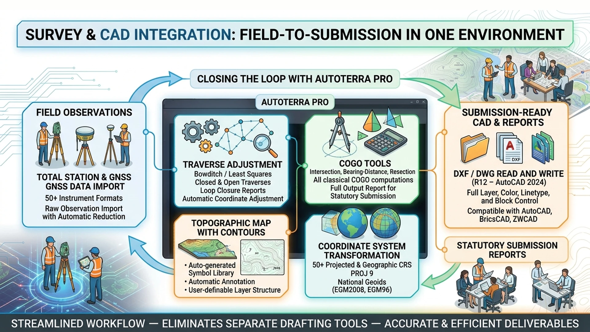
AutoTerra Pro closes the loop between field survey and office CAD deliverable without the need for a separate drafting tool. Import raw observations, adjust, generate a topo map, and export a fully-layered DXF — all without leaving AutoTerra.
Every module that an engineering survey team needs — no add-ons, no extra licenses.
DTM, DSM, nDHM, contours, slope, aspect, curvature, hillshade, and volume calculations.
Cross-sections, long profiles, and quantity takeoff along any alignment — automated and submission-ready.
Instrument data import, traverse adjustment, COGO, control points, and stake-out — full survey office toolkit.
Full DXF/DWG read and write with layer, linetype, and block support — compatible with every major CAD platform.
Vector and raster GIS exports compatible with ESRI, QGIS, and MapInfo — ready for hand-off to GIS teams.
Detailed earthwork and stockpile reports with tabular and graphical output — audit-ready for clients and agencies.
AutoTerra Pro is the natural home for any team whose work centres on survey, terrain, and CAD deliverables — and who doesn't yet need the LiDAR-at-scale capabilities of Pro Spatial.
Cadastral surveys, topographic mapping, traverse processing, and DXF deliverables for statutory submission — all in one environment, without a separate CAD tool.
Road and canal cross-sections, earthwork quantities, DTM for drainage design, and volume calculations between proposed and existing surfaces.
Stockpile volumes, pit floor surveys, strata-wise section generation, and period-on-period change analysis from total station or drone survey data.
AutoTerra Pro sits between Standard (basic terrain) and Pro Spatial (full LiDAR + corridor platform). If your work is survey, CAD, and terrain — Pro has everything you need.
Key capabilities of the Pro edition. See the full edition comparison →
| Capability | Detail |
|---|---|
| Survey import | 50+ total station and GNSS formats; raw observation import with automatic reduction; CSV/TXT field notes |
| Traverse adjustment | Bowditch (compass rule) and Least Squares; closed and open traverses; closure report |
| COGO tools | Intersection, bearing-distance, resection, offset, area calculation, stake-out |
| Terrain outputs | DTM, DSM, nDHM, contours, slope, aspect, curvature, hillshade, TPI — all at user-defined resolution |
| Interpolation | Delaunay TIN (primary), IDW, Natural Neighbour; break-line and boundary constraint |
| Section generation | Cross-sections and L-sections along alignments; user-defined chainage interval; formation level and pavement layer definition; strata-wise sections |
| Volume methods | Prismatoid, average end area, TIN-to-TIN; stockpile volumes; cut/fill breakdown by layer |
| CAD | DXF read/write (R12–2024), DWG read (ODA library); full layer, linetype, block, and attribute support |
| GIS vector | SHP, GeoJSON, KML/KMZ, GeoPackage read and write |
| GIS raster | GeoTIFF (cloud-optimized), ASCII/ESRI Grid, ERDAS IMG, PNG, JPEG — embedded projection |
| Coordinate systems | 50+ projected & geographic CRS; PROJ 9; vertical datum transforms (EGM2008, EGM96, national geoids) |
| Point cloud | LAS/LAZ viewing and basic editing; rule-based classification; no AI classification or GPU rendering (upgrade to Spatial or Pro Spatial) |
| Licensing | Node-locked (standard) or floating network license; online activation; offline transfer available |
| OS | Windows 10/11 (64-bit); 8 GB RAM minimum, 16 GB recommended; OpenGL 4.1+ |
Buy online or request a 30-day trial — our team will get back to you within one business day.