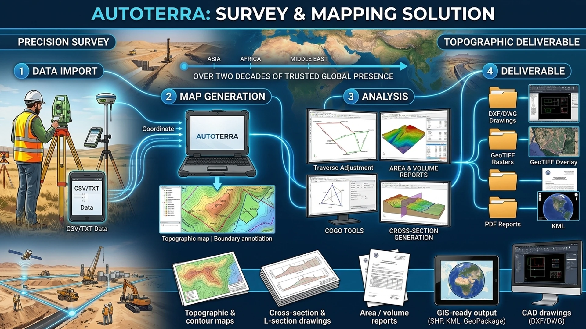
Precision survey — from total station to topographic deliverable
AutoTerra has been the surveyor's tool of choice across Asia, Africa, and the Middle East for over two decades.
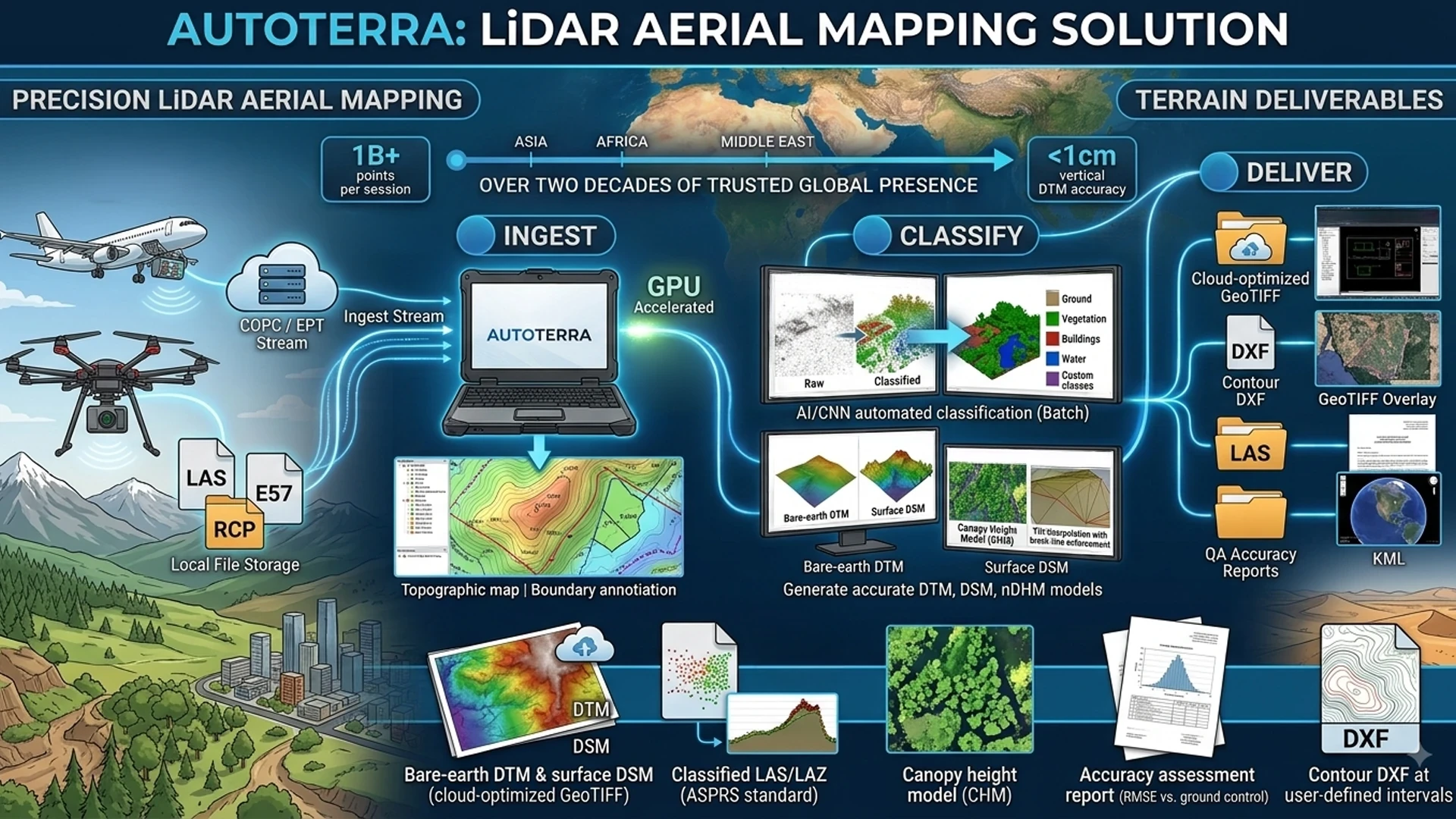
From raw airborne or drone LiDAR to publication-ready terrain
Mapping bureaux and geospatial companies rely on AutoTerra Pro Spatial and LiDAR Pro to process airborne and drone-borne LiDAR datasets at scale. GPU-accelerated processing, AI classification, and full raster-output pipelines keep production schedules on track even for national-scale surveys.
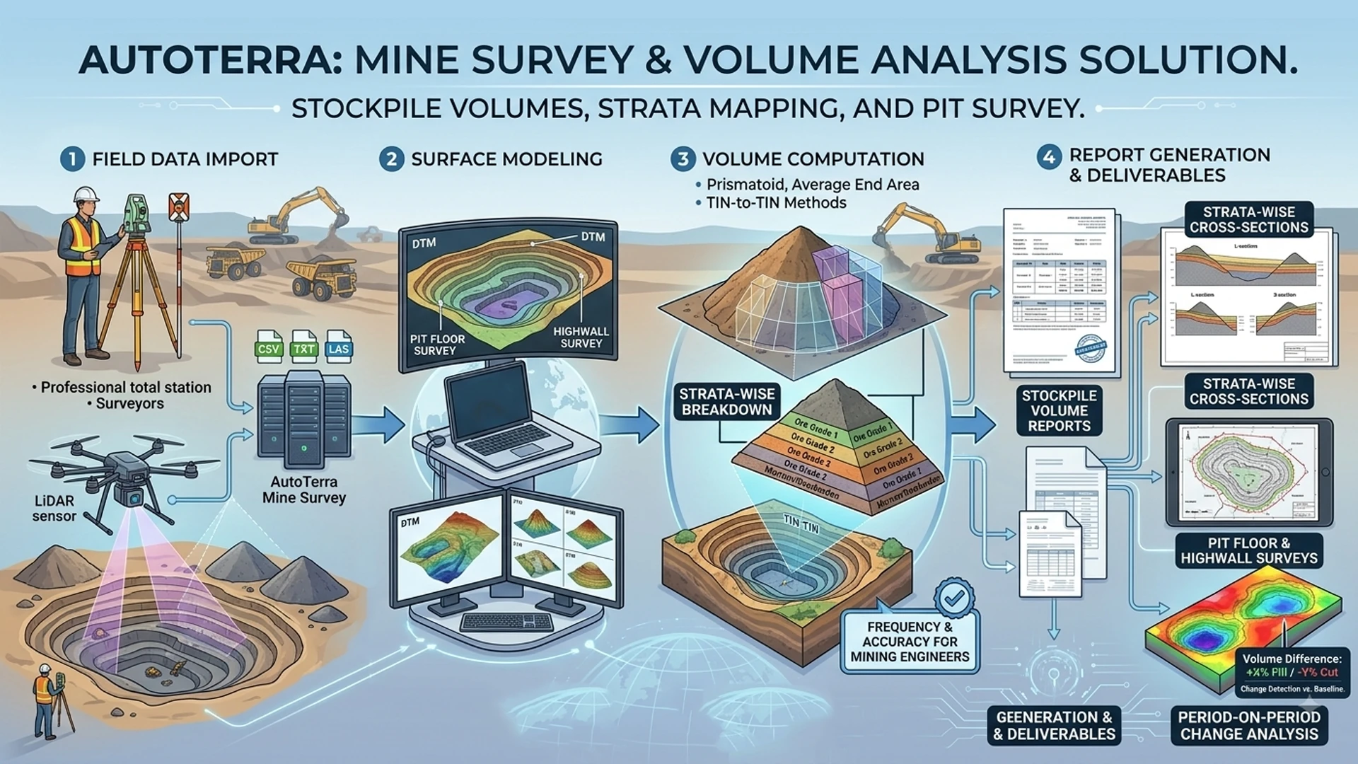
Stockpile volumes, strata mapping, and pit survey
Mining operations demand frequent, accurate volume calculations from survey data. AutoTerra streamlines the complete mine survey workflow — from field data import to stockpile volume reports and strata-wise cross-sections — with the accuracy and auditability that mining engineers need.
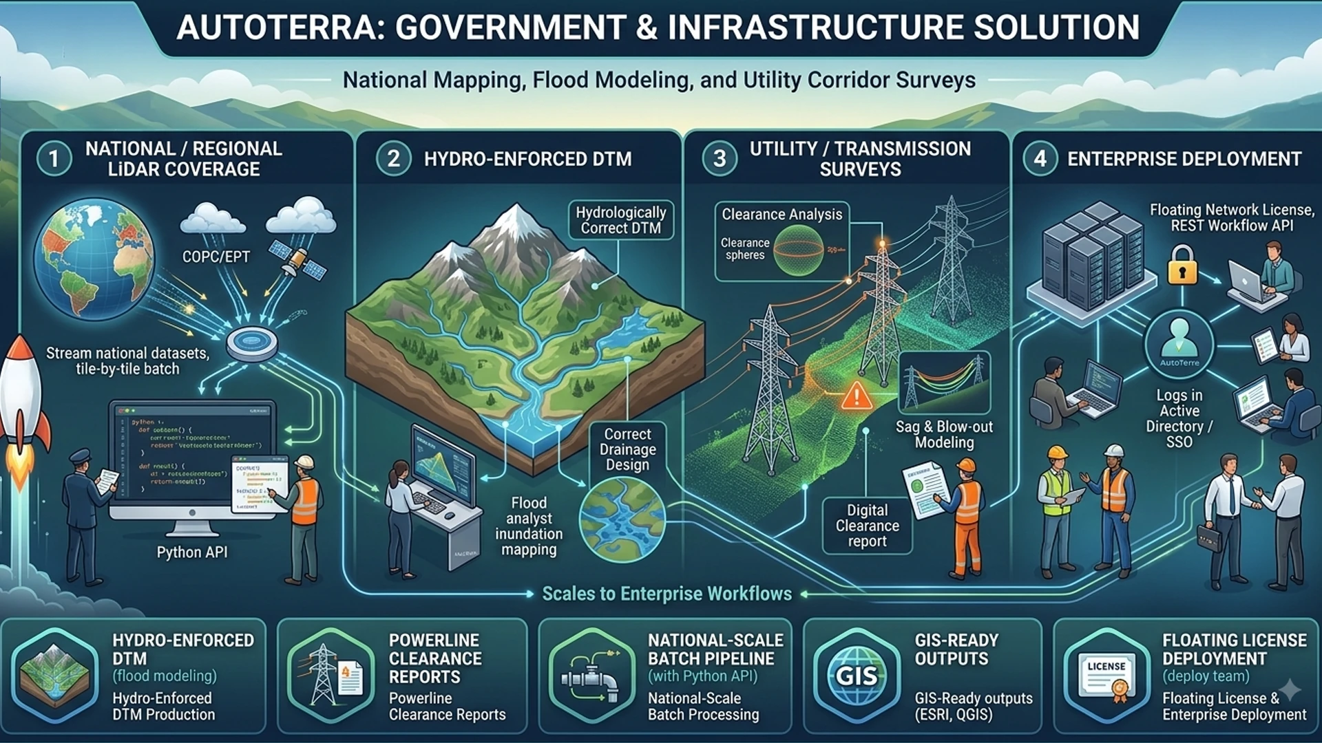
National mapping, flood modeling, and utility corridor surveys
Government agencies, national mapping organisations, and utility companies choose AutoTerra for its floating-license model, Python scripting API, and auditability. From hydrological DTM production to transmission-line corridor surveys, AutoTerra scales to enterprise workflows.
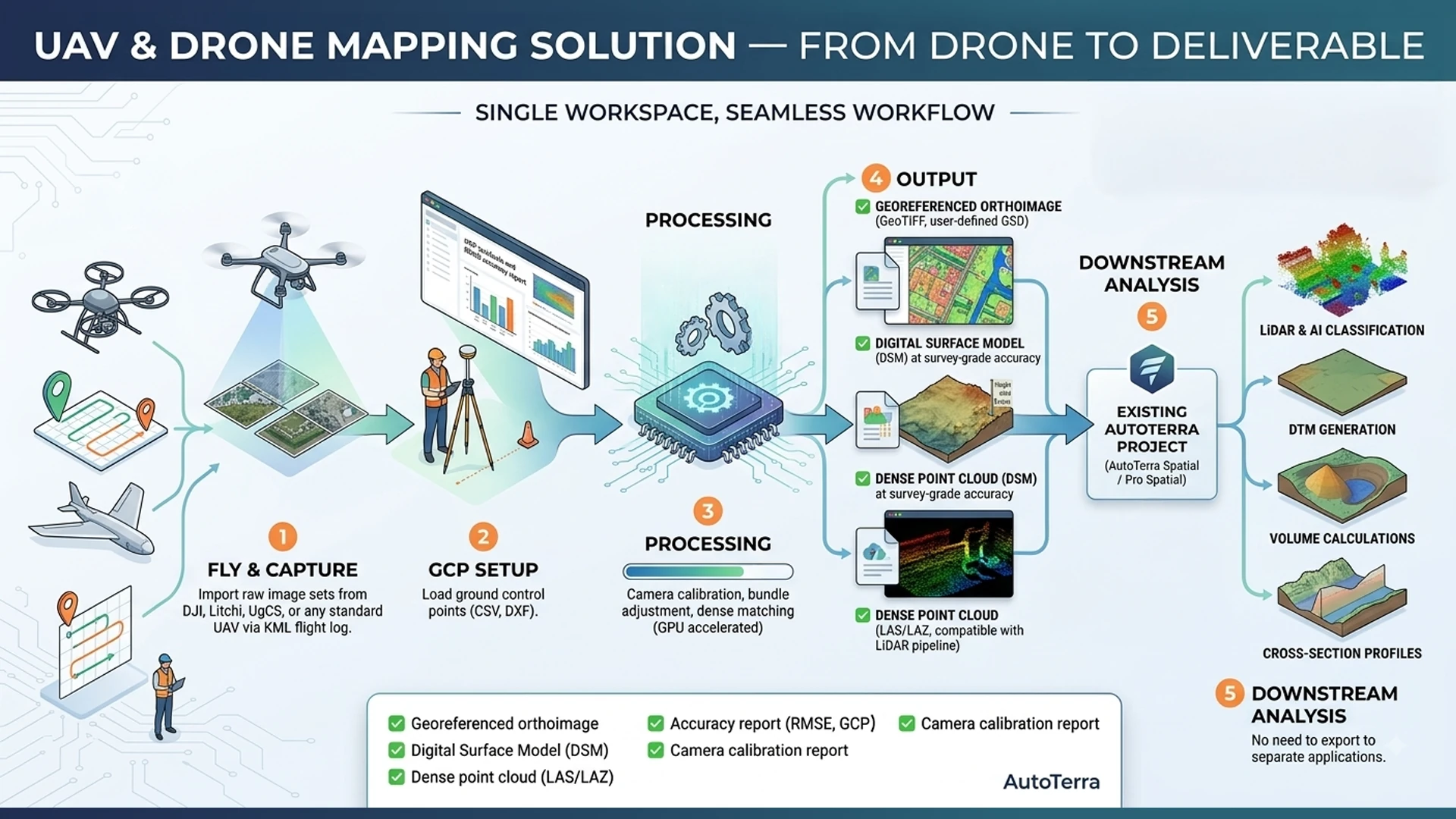
From drone to deliverable — in a single workspace
The UAV Photogrammetry add-on (available for AutoTerra Spatial and Pro Spatial) closes the gap between field capture and final survey output. Import raw image sets from any multi-rotor or fixed-wing UAV, run bundle adjustment and dense matching, and deliver georeferenced orthoimages, DSMs, and classified point clouds — all within your existing AutoTerra project.
Because the output feeds directly into AutoTerra's LiDAR classification and terrain pipeline, UAV-derived point clouds can be classified, filtered, and used for DTM generation, volume calculations, and cross-section profiles without exporting to a separate application.