Fly in the morning. Hand over ortho, DSM and volumes from one seat.
Photogrammetry, ground classification, surfaces, CAD and volume reports in one program. Process on your own computer with no per-image fees, or send heavy jobs to AutoTerra Cloud.
No GPU needed to start. AutoTerra also runs on CPU-only computers, more slowly.
Most drone software stops at the orthomosaic. Your client's job doesn't.
Skip the exports between a photogrammetry tool, a point-cloud tool and CAD. The project carries through.
Images and control
Import the flight, align the cameras, then mark your ground control.
Cloud, ortho, DSM
Dense cloud, orthomosaic and DSM, with a textured mesh if you need one.
Ground and volumes
Classify the ground, build the DTM, then run contours, sections and cut/fill.
What the client signs
GeoTIFF, LAS, DWG, PDF and Excel, plus a browser link through Cloud.
Ground control that doesn't take all afternoon
Import your control list and mark a target in a couple of images. AutoTerra projects it into the others for you to confirm, so you check marks rather than hunt for them.
- Control from CSV, TXT or another project
- Check points stay out of the adjustment and are reported separately
- RTK accuracy tags read from the image metadata
- Handles wide-angle cameras such as GoPro, as well as survey drones
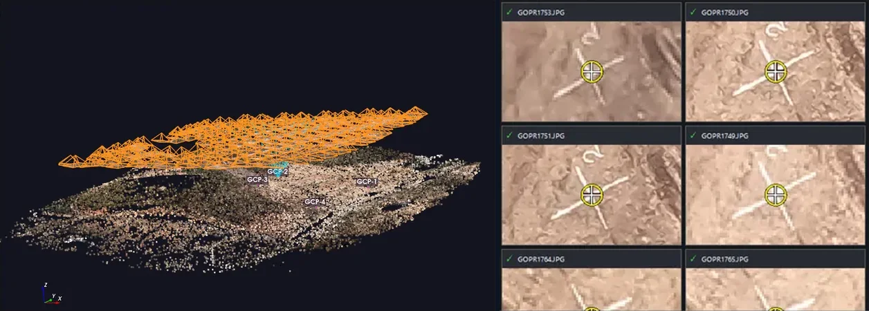
Camera positions and tie points, with one target marked across images.
A report that answers the client's accuracy question
Every project produces a branded PDF report, and projects on AutoTerra Cloud also get it online, so the question of how accurate the survey is has a checkable answer.
- Control and check point errors, point by point
- Camera calibration, keypoints and bundle adjustment results
- Flight path, image overlap and ground resolution
- Previews of the ortho and DSM, plus coordinate system
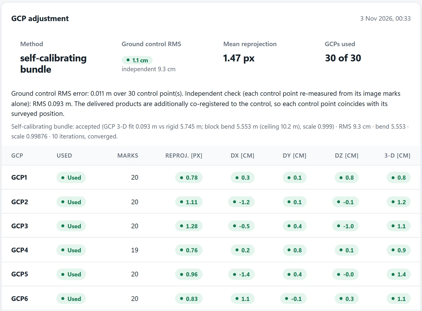
A real Quality Report page: every control point's error, with an independent check beside the fit.
Deliverables at the resolution you flew
Build the dense cloud, then the orthomosaic and DSM as GeoTIFFs. Warp them to your surveyed control when the client's control must hold. Add a textured mesh for visual work.
- Orthomosaic and DSM as GeoTIFF
- Dense cloud as LAS or LAZ
- Textured mesh as OBJ or GLB, with its coordinate offset
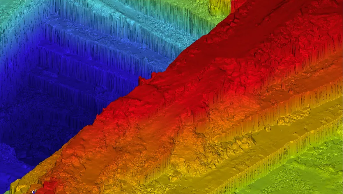
A quarry surface in the 3D view, coloured by elevation.
Then do the part you actually bill for
One click opens the dense cloud in the point cloud editor. Classify the ground, build the DTM, and work out the volumes and contours in the same project, without a round trip to other software.
- Ground classification tuned for drone clouds and steep faces
- Cut/fill between surfaces or to a datum, with an exact geometric method
- Contours and sections, saved as DWG or DXF
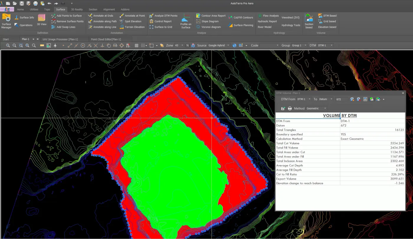
Volume by DTM against a datum: cut, fill, areas and balance level.
No GPU on site? Use ours, and pay for the minutes you use.
Send heavy stages to cloud GPUs right from the app. Then give your client a link to the orthomosaic and surface, with nothing to install. Results come back to your desktop for CAD, contours and final volumes.
- Charged by GPU time, never per image or per hectare: 1 credit ≈ 1 GPU-minute
- Quoted before each stage, with unused credits refunded
- Browser viewer with heights, profiles, distances, areas and volume previews
- View-only share links for clients and site teams
- Yearly credits included with Aero and Pro Aero; top up any time
- From AutoTerra Pro upward, upload whole projects too: clouds, surfaces, rasters and drawings, with drawing edits coming back to your desktop
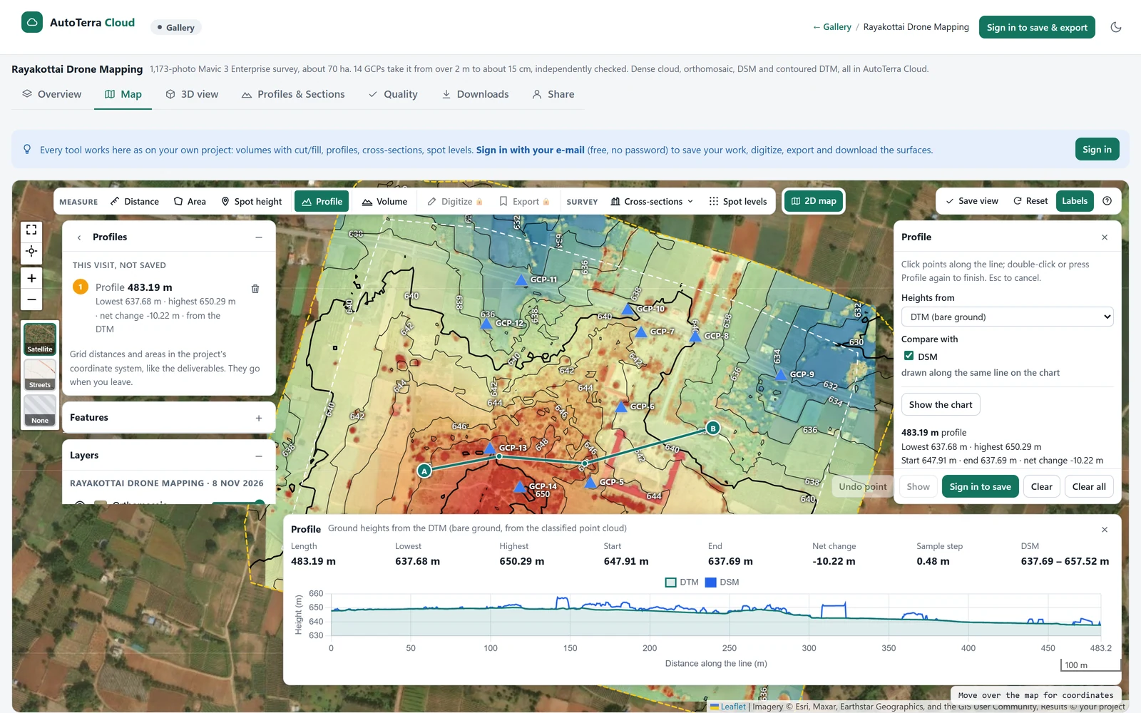
cloud.autoterra.net
What you hand over
Choose by what you deliver
AutoTerra Aero
Drone processing, ground classification, DTM and contours. Opens clouds up to 100 million points, and processes drone images on Cloud. No sections, volumes, ML or whole-project upload.
See detailsAutoTerra Pro Aero
Everything in Aero, plus sections, volumes, ML classification, whole-project upload to Cloud and clouds up to 1 billion points. Includes 6 onboarding sessions on annual terms.
Start free trialCloud credit packs
Yearly credits come with Aero and Pro Aero. Bought credits never expire. Processing on your own computer uses no credits.
Open AutoTerra CloudPrices exclude GST or local taxes. 3-month to 5-year terms. Multi-seat pricing on request.
Before you start
Do we need a GPU?
No. AutoTerra runs on CPU-only computers, and it's faster with an NVIDIA GPU. For big jobs without one, use AutoTerra Cloud.
Which drones work?
Geotagged images from survey drones and action cameras, including wide-angle lenses such as GoPro. Send a sample flight if you're unsure.
Are there per-image or per-hectare fees?
No. Processing on your own computer has no such fees. Cloud is charged by GPU time, and is optional.
Can we try it on our own flight?
Yes. The 30-day Pro Aero trial is the complete platform. Or send us a flight and we'll process it with you on a demo.
Run your last flight through AutoTerra
Start the 30-day trial, or send us the images and we'll walk through the deliverables with you.