Let the terrain propose the route. Issue the TCS in one run.
Route search, alignment, typical cross-sections, cross-drainage and sheets in one seat — built around IRC hill-road practice, from the survey you already have.
Send us a DTM or point cloud with a start and end point. We'll run it with you live.
Start from routes that can be built, not from a line you hope will work
Give it a start, an end and your design criteria. AutoRoads searches the whole terrain and returns genuinely different routes that respect your radius and grade limits, then lands the chosen one as a design alignment with nothing to re-digitise.
- Hairpins laid out at IRC spacing, not left to chance
- Holds the ruling grade, relaxing to limiting and exceptional only where it must
- Finds development length on climbs too steep for a direct line
- Proposes bridges and tunnels where they beat deep cut or high fill
- Avoid zones and boundaries keep it out of what you can't touch
Greenfield is included in AutoRoads Spatial and AutoRoads Aero.
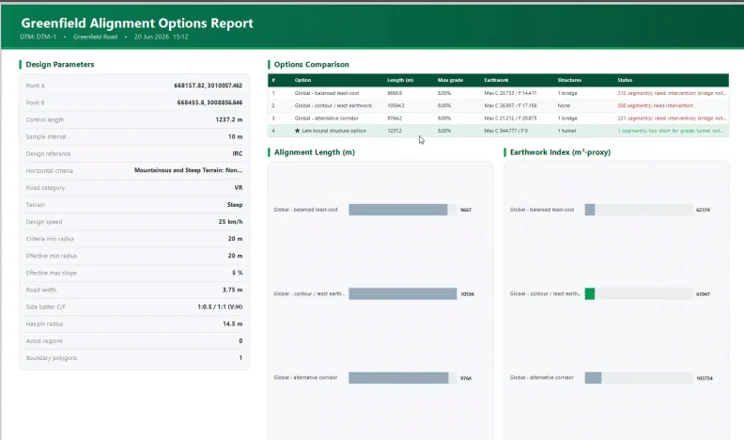
The options report: criteria, comparison and normative cost from the MoRTH reference or your own rates — a feasibility deliverable in itself.
The whole TCS schedule, drafted for your review
AutoRoads applies your template at every station against the real ground, measures both sides, and divides the corridor into numbered stretches. The same arrangement always gets the same TCS number. You review, adjust and issue.
- Stretches and TCS numbers built from cut, fill and protection on each side
- Stays stable: run it again and only what changed gets a new code
- Culverts, bridges, VUPs, ROBs, viaducts, tunnels, walls and drains all set the stretches
- Merge, relaxed merge, split, exclude and lock — your decisions are kept
- Check any station against the ground, with the point cloud overlaid
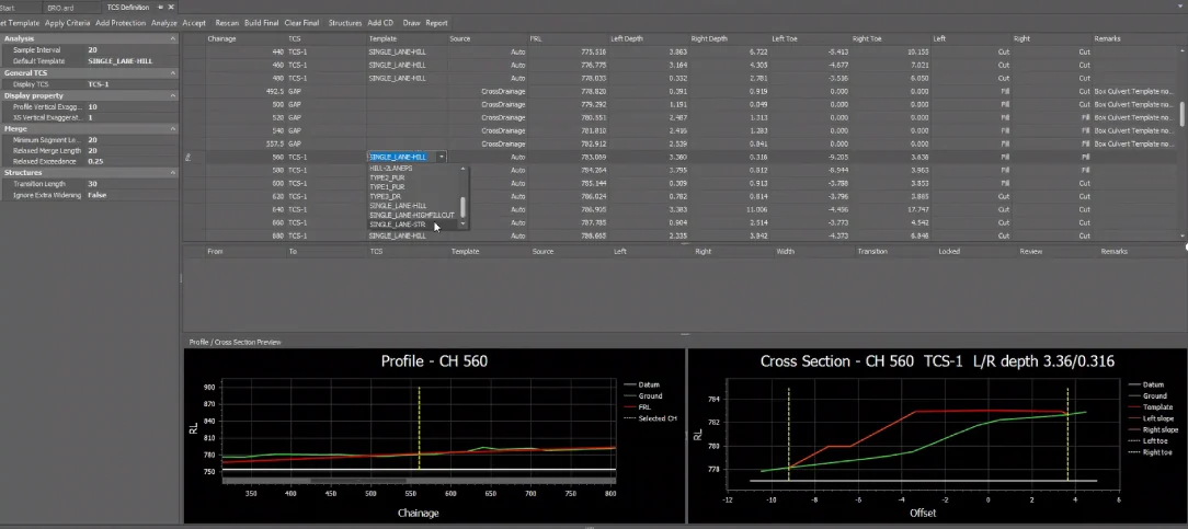
TCS Definition: every station, its template, depths, toes and class, with profile and section side by side.
It doesn't only sort the stretches. It finds the problems in them.
Each of these runs from the same analysis, so your schedule, walls, structures and cost all agree.
Plan and profile that can't drift apart
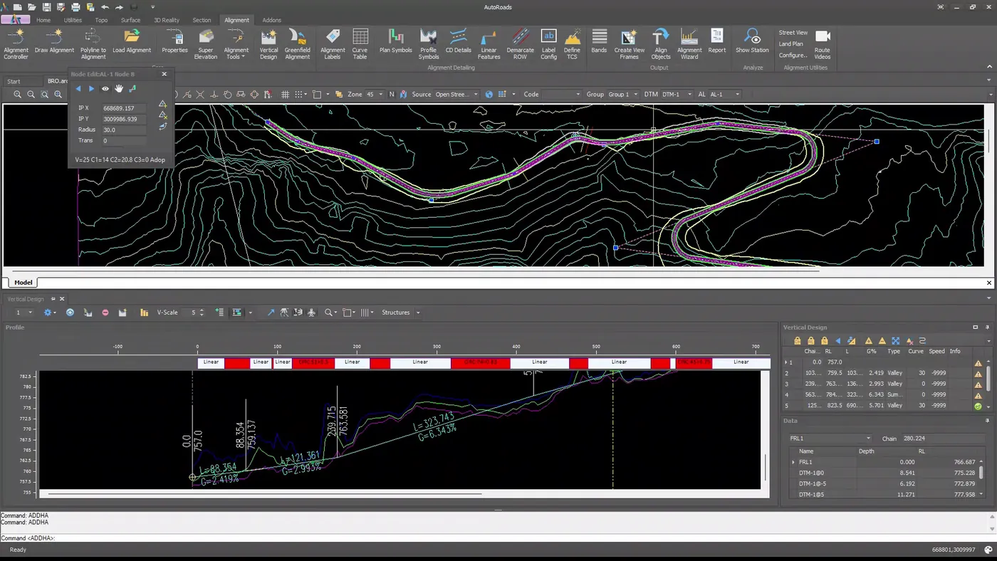
Move an IP and the grades, curve warnings and corridor toes follow. Design standards change by chainage, so one alignment can pass through several terrain classes and design speeds.
- Spirals, compound and reverse curves; vertical curves by K-value
- Per-curve compliance warnings as you edit
- Toes and footprint recalculated as the design changes
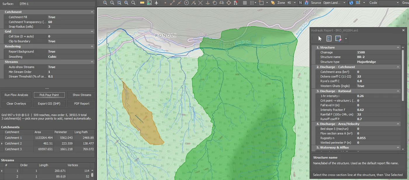
Every crossing backed by checkable hydraulics
Delineate the catchment on the same DTM and run the IRC chain: discharge, waterway, afflux, scour and foundation level. You get an editable workbook per structure, with live formulas.
- Dickens, Ryve's, Inglis, Rational and area-velocity methods
- Lacey scour and foundation levels per IRC:78
- Rivers export to HEC-RAS, ISIS and MIKE
Drawings your client can issue
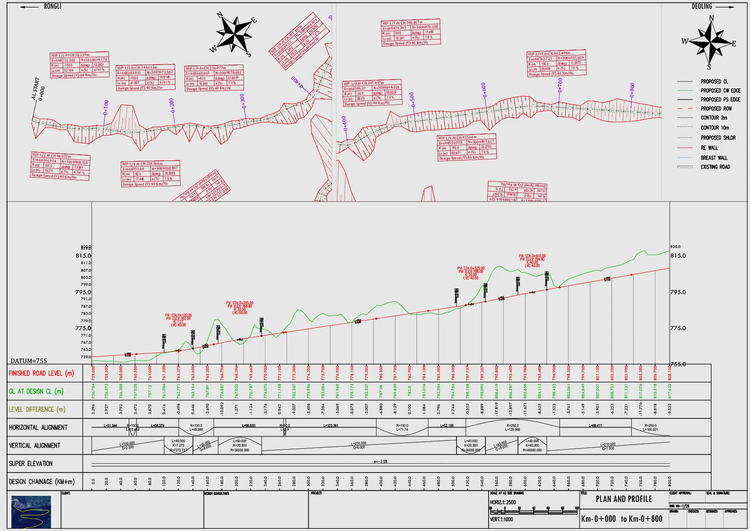
The same model produces plan and profile sheets with view frames, a band designer and title blocks, plus cross-section sheets at any interval. Change the design and regenerate.
- TCS, walls and toes drawn onto the plan automatically
- Multi-sheet plan and profile with configurable bands
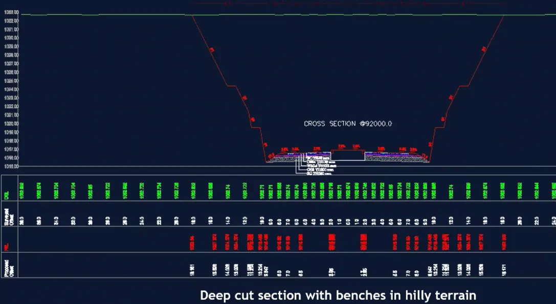
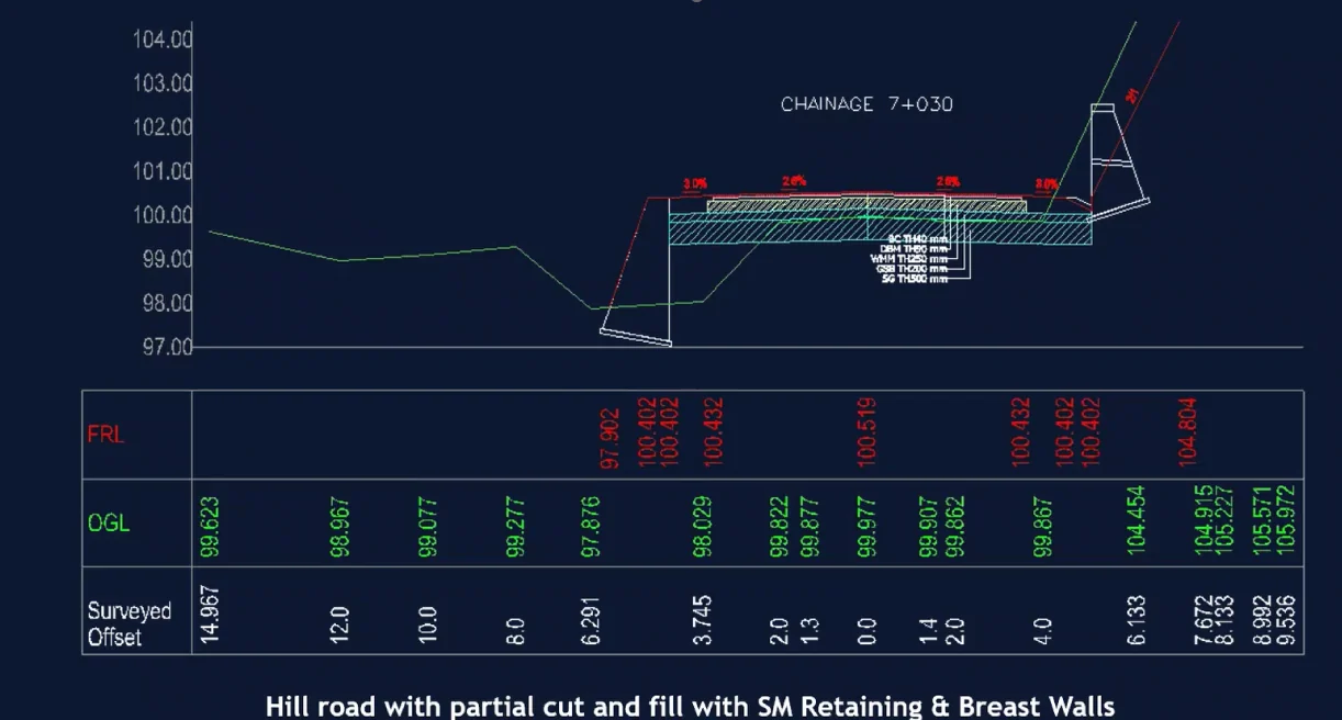
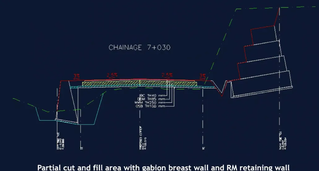
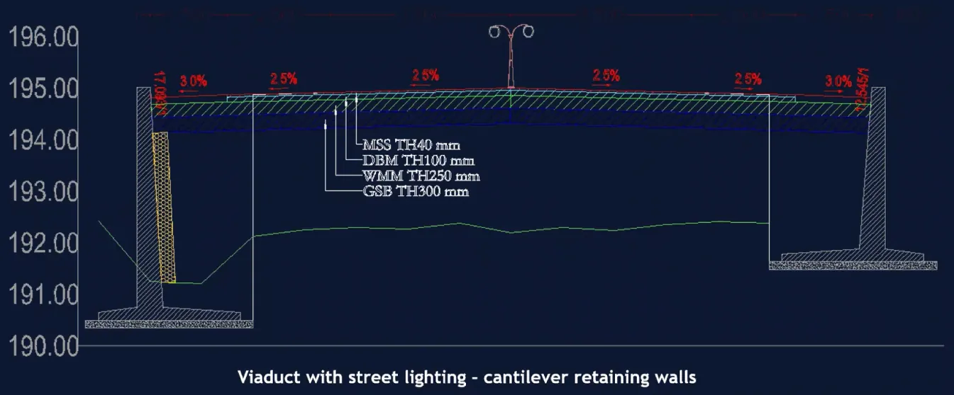
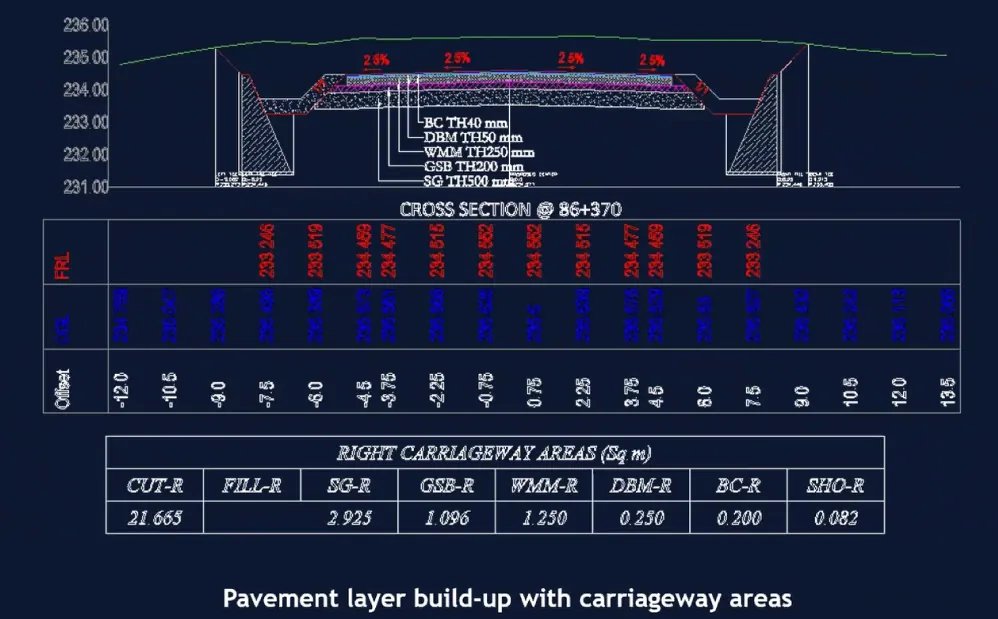
- Cross-sections with layers, areas and quantities
Sections the way hill roads are actually built
What you hand over
Choose by how your survey arrives
AutoRoads
Alignment, TCS, structures, hydraulics and sheets. No point clouds or Greenfield.
Ask for a quoteAutoRoads Spatial
Everything in AutoRoads, plus Greenfield route search and the full point-cloud platform.
Book a demoAutoRoads Aero
Everything in AutoRoads Spatial, plus drone photogrammetry in the same seat.
Ask for a quoteBefore you start
Which standards does it follow?
A design-standard library covering IRC hill-road standards (IRC:SP:48, IRC:52, IRC:73), AASHTO and comparable codes. Terrain class and design speed can change by chainage.
Is the route search a final design?
No. It gives you feasible, comparable options and a starting alignment. Your engineers review and finish the design. Cost is normative, for comparing options, not a project estimate.
Does the TCS replace the engineer?
It does the analysis and first schedule. Walls and structures are proposals; cross-drainage is only ever suggested until you accept it, and your edits are kept.
Can we try it on our own project?
Yes. Send us a DTM or point cloud with a start and end point, and we'll walk through it with you on a demo.
See it run on your corridor
Send a start point, an end point and your survey. We'll show you the routes and the TCS live.